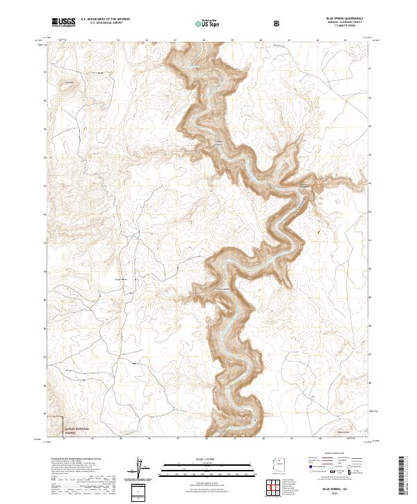
2021 Map of Blue Spring
USGS Topo · Published 2021About this map
The Little Colorado River Gorge dominates this landscape, cutting a deep path through the high desert of Coconino County. At its heart lies Blue Spring, a significant hydrological feature where mineral-rich waters feed into the Little Colorado River. The surrounding terrain is defined by dramatic erosional features like Straight Canyon, Waterhole Canyon, and Cedar Canyon, which all drain toward the central gorge. Along the western edge, the boundary of the Kaibab National Forest meets the rugged topography near Gold Hill and the broad Lower Basin. While largely undeveloped, the map shows Indian Rte 6134 crossing the northern reaches, providing sparse access to this complex network of plateaus and steep-walled canyons. The intricate contour lines illustrate the stark elevation changes between the rim and the river floor, capturing the geological character of the region in the early 21st century.
Find a feature on this map
17 named features on this map. Tap any name to fly to it.
Don’t see what you’re looking for? This feature index may not catch every label — zoom into the map to look around manually.
Map Details
Editions of this 2021 Blue Spring Map
This is the sole edition of this map. No revisions or reprints were ever made.
Other maps of this area

1886 · San Francisco Mtns
USGS Topo · 1:250,000

1886 · Echo Cliffs
USGS Topo · 1:250,000

1891 · San Francisco Mtns
USGS Topo · 1:250,000

1891 · Echo Cliffs
USGS Topo · 1:250,000

1894 · San Francisco Mtns
USGS Topo · 1:250,000

1899 · San Francisco Mtns
USGS Topo · 1:250,000

1907 · Vishnu
USGS Topo · 1:48,000

1947 · Flagstaff
USGS Topo · 1:250,000

1954 · Flagstaff
USGS Topo · 1:250,000

1955 · Coconino Pt NE
USGS Topo · 1:24,000