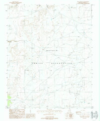
1988 Map of Blue Spring SE
USGS Topo · Published 1988About this map
The Navajo Indian Reservation landscape is documented here during a 1980s field check, revealing a high-desert environment defined by significant drainage systems. Primary topographical features include the winding path of Big Canyon in the north and the westward-reaching Waterhole Canyon. This provisional survey illustrates the practical infrastructure of the era, noting scattered livestock Corral sites and water management features like the Check Dam installations found throughout the arid terrain. The map reflects a territory primarily shaped by natural erosion patterns and traditional land use, with very few modern developments or permanent settlements noted beyond these functional landmarks.
Find a feature on this map
5 named features on this map. Tap any name to fly to it.
Don’t see what you’re looking for? This feature index may not catch every label — zoom into the map to look around manually.
Map Details
Editions of this 1988 Blue Spring SE Map
This is the sole edition of this map. No revisions or reprints were ever made.
Other maps of this area

1886 · San Francisco Mtns
USGS Topo · 1:250,000

1886 · Echo Cliffs
USGS Topo · 1:250,000

1891 · San Francisco Mtns
USGS Topo · 1:250,000

1891 · Echo Cliffs
USGS Topo · 1:250,000

1894 · San Francisco Mtns
USGS Topo · 1:250,000

1899 · San Francisco Mtns
USGS Topo · 1:250,000

1947 · Flagstaff
USGS Topo · 1:250,000

1954 · Flagstaff
USGS Topo · 1:250,000

1955 · Coconino Pt NE
USGS Topo · 1:24,000

1955 · Blue Spring NE
USGS Topo · 1:24,000