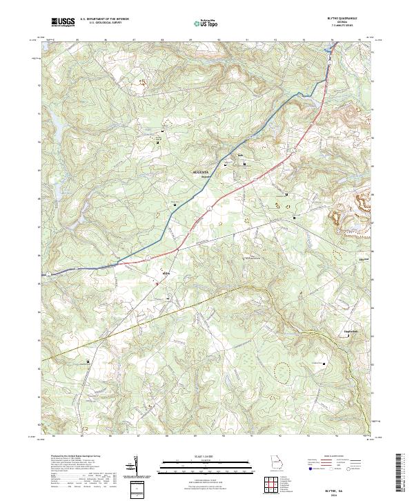
2024 Map of Blythe
USGS Topo · Published 2024About this map
Fort Gordon borders the northern reaches of this survey, where the wooded landscape gives way to the communities of Blythe and Bath. The area is characterized by an intricate network of family and community burial grounds, including the Bath Presbyterian Cem, Tarver Cem, and Saxon Cem, reflecting the deep-seated residential history of southern Richmond County. Small agricultural ponds and minor watercourses like Union Mill Pond and Rachel Branch are scattered throughout the terrain, indicating a legacy of local milling and farming. The southern edge of the map follows the winding path of McBean Creek at the Richmond Co Burke Co line. Near the center, the Pea Patch Aerodrome serves as a modern aeronautical landmark amidst the traditional rural road network of Deans Bridge Rd and Patterson Bridge Rd.
Find a feature on this map
104 named features on this map. Tap any name to fly to it.
Don’t see what you’re looking for? This feature index may not catch every label — zoom into the map to look around manually.
Map Details
Editions of this 2024 Blythe Map
This is the sole edition of this map. No revisions or reprints were ever made.
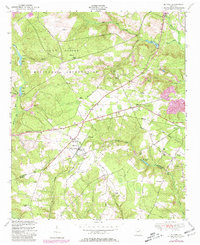
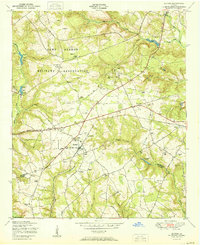
Historical Maps of Augusta Through Time
3 maps found