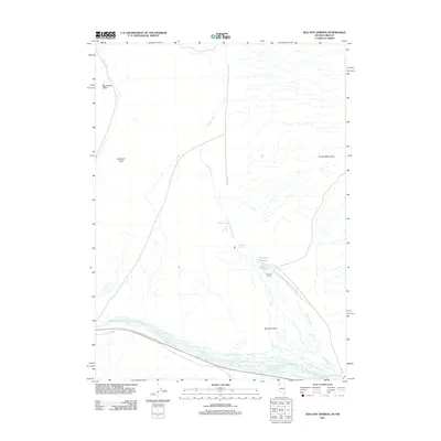
2011 Map of Bog Hot Springs
USGS Topo · Published 2011About this map
Bog Hot Springs and the surrounding high desert of Humboldt County define this landscape along the Nevada-Oregon border. The terrain is characterized by geothermal activity and seasonal water flow, with Warm Springs and Cold Spring feeding into the drainage of Rincon Creek. In the southeastern portion of the quadrangle, Bog Hot Reservoir and the Bog Hot Ranch represent the primary human imprint on this arid environment, situated where the creek enters Bog Hot Valley. The eastern edge of the map is dominated by the rising slopes of the Pueblo Mountains, while to the west, the flat-topped Big Spring Table and the distinct landmark of Railroad Point overlook the braided channels of Thousand Creek. The distribution of these water sources illustrates the critical role of springs and reservoirs in supporting ranching and local ecosystems in this remote corner of the Great Basin.
Find a feature on this map
11 named features on this map. Tap any name to fly to it.
Don’t see what you’re looking for? This feature index may not catch every label — zoom into the map to look around manually.
Map Details
Editions of this 2011 Bog Hot Springs Map
This is the sole edition of this map. No revisions or reprints were ever made.
Other maps of this area

1886 · Disaster
USGS Topo · 1:250,000

1893 · Disaster
USGS Topo · 1:250,000

1954 · Vya
USGS Topo · 1:250,000

1955 · Adel
USGS Topo · 1:250,000

1957 · Adel
USGS Topo · 1:250,000

1958 · Vya
USGS Topo · 1:250,000

1958 · Adel
USGS Topo · 1:250,000

1962 · Vya
USGS Topo · 1:250,000

1962 · Adel
USGS Topo · 1:250,000

1965 · Railroad Point
USGS Topo · 1:62,500