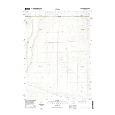
2015 Map of Bog Hot Springs
USGS Topo · Published 2015About this map
Bog Hot Springs and the surrounding high desert terrain anchor this study of the borderlands between Nevada and Oregon. The landscape is defined by its hydrothermal activity and seasonal water flow, with drainage collected into Bog Hot Reservoir via Rincon Cr. The proximity of Warm Springs and Cold Spring illustrates the complex subterranean hydrology of the Great Basin, where geothermal heat reaches the surface in an otherwise arid expanse. In the south, the terrain opens into Bog Hot Valley while Thousand Cr winds through the lower elevations. Evidence of the region's geography and navigation is found at Railroad Point and across the flat top of Big Spring Table. This survey captures the remote character of Humboldt and Harney counties, documenting a place where water sources dictate the shape of human activity and natural landmarks.
Find a feature on this map
18 named features on this map. Tap any name to fly to it.
Don’t see what you’re looking for? This feature index may not catch every label — zoom into the map to look around manually.
Map Details
Editions of this 2015 Bog Hot Springs Map
This is the sole edition of this map. No revisions or reprints were ever made.
Other maps of this area

1886 · Disaster
USGS Topo · 1:250,000

1893 · Disaster
USGS Topo · 1:250,000

1954 · Vya
USGS Topo · 1:250,000

1955 · Adel
USGS Topo · 1:250,000

1957 · Adel
USGS Topo · 1:250,000

1958 · Vya
USGS Topo · 1:250,000

1958 · Adel
USGS Topo · 1:250,000

1962 · Vya
USGS Topo · 1:250,000

1962 · Adel
USGS Topo · 1:250,000

1965 · Railroad Point
USGS Topo · 1:62,500