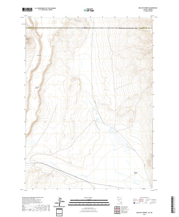
2021 Map of Bog Hot Springs
USGS Topo · Published 2021About this map
Bog Hot Springs and the surrounding high desert terrain characterize this modern look at the borderlands where Nevada and Oregon meet. The landscape is defined by its thermal features and water management, including Warm Springs, Cold Spring, and the Bog Hot Reservoir. These water sources are vital in the arid Bog Hot Valley, a geography carved by Thousand Cr and Rincon Cr. The topography transitions from the low-lying valley floor to prominent elevations like Big Spring Table and Railroad Point. The map also captures the administrative boundary between Harney County and Humboldt County, as well as the lonely stretch of Oregon End Table Rd traversing the northern edge of the quadrangle. This detailed survey documents the hydrological and geological character of a remote basin system at the start of the 2020s.
Find a feature on this map
19 named features on this map. Tap any name to fly to it.
Don’t see what you’re looking for? This feature index may not catch every label — zoom into the map to look around manually.
Map Details
Editions of this 2021 Bog Hot Springs Map
This is the sole edition of this map. No revisions or reprints were ever made.
Other maps of this area

1886 · Disaster
USGS Topo · 1:250,000

1893 · Disaster
USGS Topo · 1:250,000

1954 · Vya
USGS Topo · 1:250,000

1955 · Adel
USGS Topo · 1:250,000

1957 · Adel
USGS Topo · 1:250,000

1958 · Vya
USGS Topo · 1:250,000

1958 · Adel
USGS Topo · 1:250,000

1962 · Vya
USGS Topo · 1:250,000

1962 · Adel
USGS Topo · 1:250,000

1965 · Railroad Point
USGS Topo · 1:62,500