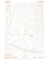
1990 Map of Bog Hot Springs
USGS Topo · Published 1990About this map
Bog Hot Valley straddles the high-desert borderlands of Nevada and Oregon, where thermal activity and seasonal water define the landscape. This 1990 provisional sheet captures the intersection of the Sheldon National Wildlife Refuge and the southern reaches of the Pueblo Mountains. The presence of Bog Hot Springs and Bog Hot Reservoir highlights the critical role of water management in this arid environment, supporting the isolated Bog Hot Ranch and local wildlife populations.
Find a feature on this map
16 named features on this map. Tap any name to fly to it.
Don’t see what you’re looking for? This feature index may not catch every label — zoom into the map to look around manually.
Map Details
Editions of this 1990 Bog Hot Springs Map
This is the sole edition of this map. No revisions or reprints were ever made.
Other maps of this area

1886 · Disaster
USGS Topo · 1:250,000

1893 · Disaster
USGS Topo · 1:250,000

1954 · Vya
USGS Topo · 1:250,000

1955 · Adel
USGS Topo · 1:250,000

1957 · Adel
USGS Topo · 1:250,000

1958 · Vya
USGS Topo · 1:250,000

1958 · Adel
USGS Topo · 1:250,000

1962 · Vya
USGS Topo · 1:250,000

1962 · Adel
USGS Topo · 1:250,000

1965 · Railroad Point
USGS Topo · 1:62,500