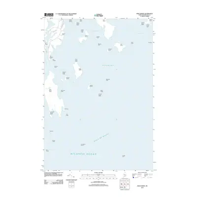
2011 Map of Bois Bubert
USGS Topo · Published 2011About this map
Bois Bubert Island and its surrounding archipelago define this maritime landscape along the Washington County coast. This survey illustrates a complex network of granite outcrops and navigational hazards where Narraguagus Bay meets the Gulf of Maine. The map serves as a vital record of the coastal shelf, detailing specific landforms such as Baldwin Head and Tom Leighton Point, alongside the intricate waterways of Douglas Island Harbor.
Find a feature on this map
51 named features on this map. Tap any name to fly to it.
Don’t see what you’re looking for? This feature index may not catch every label — zoom into the map to look around manually.
Map Details
Editions of this 2011 Bois Bubert Map
This is the sole edition of this map. No revisions or reprints were ever made.
Other maps of this area

1902 · Cherryfield
USGS Topo · 1:62,500

1904 · Cherryfield
USGS Topo · 1:62,500

1904 · Petit Manan
USGS Topo · 1:62,500

1921 · Great Wass Island
USGS Topo · 1:62,500

1921 · Columbia Falls
USGS Topo · 1:62,500

1941 · Columbia Falls
USGS Topo · 1:62,500

1942 · Cherryfield
USGS Topo · 1:62,500

1942 · Columbia Falls
USGS Topo · 1:62,500

1948 · Drisko Island
USGS Topo · 1:24,000
1948 · Petit Manan
USGS Topo · 1:24,000