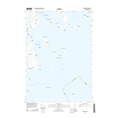
2014 Map of Bois Bubert
USGS Topo · Published 2014About this map
Bois Bubert Island and its surrounding archipelago dominate this coastal Maine survey, revealing a landscape defined by dramatic peninsulas and hazard-filled waters. The interior of the island is marked by Big Head and drains toward Seal Cove, while the surrounding Atlantic Ocean is punctuated by numerous hazards such as Mackerel Rock, Black Ledge, and Jordans Delight Ledge.
Find a feature on this map
54 named features on this map. Tap any name to fly to it.
Don’t see what you’re looking for? This feature index may not catch every label — zoom into the map to look around manually.
Map Details
Editions of this 2014 Bois Bubert Map
This is the sole edition of this map. No revisions or reprints were ever made.
Other maps of this area

1902 · Cherryfield
USGS Topo · 1:62,500

1904 · Cherryfield
USGS Topo · 1:62,500

1904 · Petit Manan
USGS Topo · 1:62,500

1921 · Great Wass Island
USGS Topo · 1:62,500

1921 · Columbia Falls
USGS Topo · 1:62,500

1941 · Columbia Falls
USGS Topo · 1:62,500

1942 · Cherryfield
USGS Topo · 1:62,500

1942 · Columbia Falls
USGS Topo · 1:62,500

1948 · Drisko Island
USGS Topo · 1:24,000
1948 · Petit Manan
USGS Topo · 1:24,000