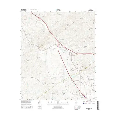
2014 Map of Bolingbroke
USGS Topo · Published 2014About this map
Bolingbroke and the surrounding Bibb and Monroe County borderlands show a landscape defined by traditional rural communities transitioning into suburban residential patterns. This 2014 survey captures the area as contemporary neighborhoods and estates like Rivoli Plantation and Field Springs Ct spread near established crossroads like Lorane. Despite modern growth, the area's deep history remains visible through its numerous community burial grounds, including the Pleasant Grove Cem, Wadley Cem, and Mt Zion Cem.
Find a feature on this map
120 named features on this map. Tap any name to fly to it.
Don’t see what you’re looking for? This feature index may not catch every label — zoom into the map to look around manually.
Map Details
Editions of this 2014 Bolingbroke Map
This is the sole edition of this map. No revisions or reprints were ever made.
Other maps of this area

1951 · Forsyth
USGS Topo · 1:62,500

1953 · Athens
USGS Topo · 1:250,000

1956 · Bolingbroke
USGS Topo · 1:62,500

1956 · Macon West
USGS Topo · 1:24,000

1956 · Macon
USGS Topo · 1:62,500

1957 · Macon
USGS Topo · 1:250,000

1958 · Macon
USGS Topo · 1:250,000

1958 · Athens
USGS Topo · 1:250,000

1959 · Athens
USGS Topo · 1:250,000

1963 · Athens
USGS Topo · 1:250,000