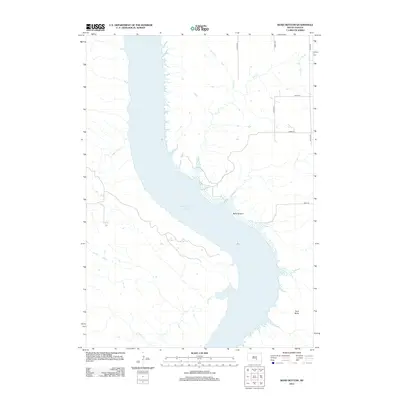
2012 Map of Bond Bottom
USGS Topo · Published 2012About this map
Lake Francis Case dominates this Missouri River landscape in Brule County, where the reservoir defines the topography of Grandview Township. The settlement of Bond Bottom sits along the northeastern shoreline, positioned near the inlet of Elm Creek. To the north, Smith Creek winds through the prairie before reaching the water, while to the south, Fivemile Creek cuts into the western bluffs. The terrain is marked by distinctive elevations such as Twin Butte on the eastern side of the reservoir. A grid of rural roads, including 345th Ave and 261st St, provides access to the agricultural uplands and the river bottomlands. This 2012 survey shows the modern configuration of the shoreline and the persistent rural infrastructure of the South Dakota plains.
Find a feature on this map
12 named features on this map. Tap any name to fly to it.
Don’t see what you’re looking for? This feature index may not catch every label — zoom into the map to look around manually.
Map Details
Editions of this 2012 Bond Bottom Map
This is the sole edition of this map. No revisions or reprints were ever made.
Other maps of this area

1940 · Iona
USGS Topo · 1:62,500

1944 · Iona
USGS Topo · 1:62,500

1952 · Iona NW
USGS Topo · 1:24,000

1955 · Mitchell
USGS Topo · 1:250,000

1959 · Mitchell
USGS Topo · 1:250,000

1971 · Lucas NW
USGS Topo · 1:24,000

1971 · Dixon
USGS Topo · 1:24,000

1971 · Dixon NE
USGS Topo · 1:24,000
1974 · Bond Bottom
USGS Topo · 1:24,000

1974 · Red Lake West
USGS Topo · 1:24,000