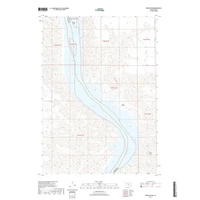
2017 Map of Bond Bottom
USGS Topo · Published 2017About this map
The Missouri River carves a deep valley through the high plains of central South Dakota on this 2017 survey, defining the boundary between Lyman and Brule counties. This stretch of the river is dominated by the waters of Lake Francis Case, a reservoir created by the Fort Randall Dam. Along the northeastern shore, the settlement of Bond Bottom sits within a wide bend, while the prominent landmark Twin Butte rises to the southeast. The landscape is characterized by steep, eroded bluffs and seasonal drainage channels like Smith Cr, Elm Cr, and Fivemile Cr that cut toward the water. Large landforms such as Bailey Island remain visible within the river channel, reflecting the topographic shifts caused by damming the Missouri during the mid-20th century.
Find a feature on this map
18 named features on this map. Tap any name to fly to it.
Don’t see what you’re looking for? This feature index may not catch every label — zoom into the map to look around manually.
Map Details
Editions of this 2017 Bond Bottom Map
This is the sole edition of this map. No revisions or reprints were ever made.
Other maps of this area

1940 · Iona
USGS Topo · 1:62,500

1944 · Iona
USGS Topo · 1:62,500

1952 · Iona NW
USGS Topo · 1:24,000

1955 · Mitchell
USGS Topo · 1:250,000

1959 · Mitchell
USGS Topo · 1:250,000

1971 · Lucas NW
USGS Topo · 1:24,000

1971 · Dixon
USGS Topo · 1:24,000

1971 · Dixon NE
USGS Topo · 1:24,000
1974 · Bond Bottom
USGS Topo · 1:24,000

1974 · Red Lake West
USGS Topo · 1:24,000