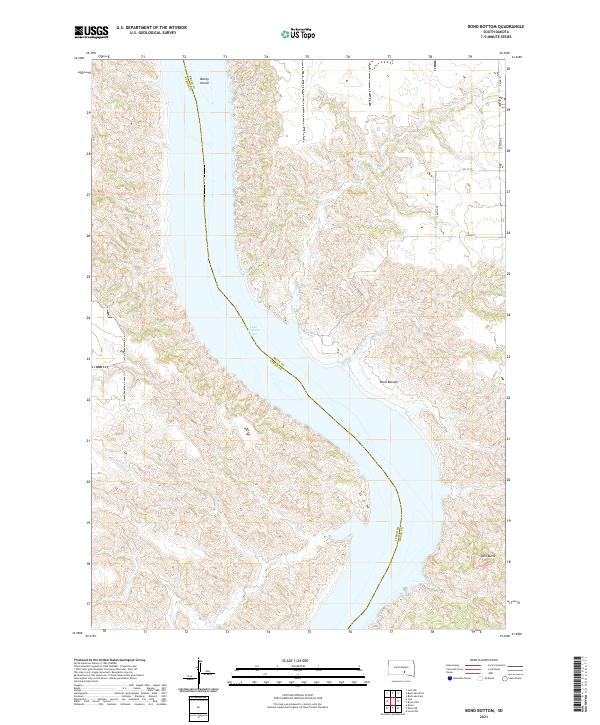
2021 Map of Bond Bottom
USGS Topo · Published 2021About this map
Lake Francis Case dominates this Missouri River landscape, following the winding boundary between Brule and Lyman counties. This modern topographic survey highlights the intricate drainage systems and dramatic relief of the Great Plains, where Fivemile Cr and Elm Cr carve deep draws into the surrounding bluffs. The map illustrates a preserved section of the river valley, featuring the low-lying Bond Bottom and the distinct elevation of Twin Butte to the southeast. Historically significant landmarks like Bailey Island remain visible within the reservoir, providing a clear view of how the waterway has shaped local topography and land use. The grid of rural roads, including Elm Creek Rd and 261 ST ST, provides access to these dissected hills and the sprawling riverfront.
Find a feature on this map
15 named features on this map. Tap any name to fly to it.
Don’t see what you’re looking for? This feature index may not catch every label — zoom into the map to look around manually.
Map Details
Editions of this 2021 Bond Bottom Map
This is the sole edition of this map. No revisions or reprints were ever made.
Other maps of this area

1940 · Iona
USGS Topo · 1:62,500

1944 · Iona
USGS Topo · 1:62,500

1952 · Iona NW
USGS Topo · 1:24,000

1955 · Mitchell
USGS Topo · 1:250,000

1959 · Mitchell
USGS Topo · 1:250,000

1971 · Lucas NW
USGS Topo · 1:24,000

1971 · Dixon
USGS Topo · 1:24,000

1971 · Dixon NE
USGS Topo · 1:24,000
1974 · Bond Bottom
USGS Topo · 1:24,000

1974 · Red Lake West
USGS Topo · 1:24,000