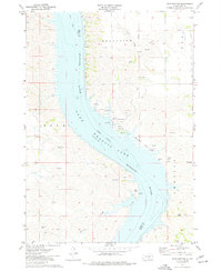
1974 Map of Bond Bottom
USGS Topo · Published 1977About this map
Lake Francis Case dominates this Missouri River valley landscape, reflecting the mid-20th-century transformation of the river following the construction of major dams. The map documents the submerged topography and new shoreline of the reservoir, bordering the townships of Grandview, Iona, and America. While much of the valley was inundated, the high ground remains defined by landmarks such as Twin Butte and the winding drainages of Smith Creek and Elm Creek.
Find a feature on this map
20 named features on this map. Tap any name to fly to it.
Don’t see what you’re looking for? This feature index may not catch every label — zoom into the map to look around manually.
Map Details
Editions of this 1974 Bond Bottom Map
This is the sole edition of this map. No revisions or reprints were ever made.
Other maps of this area

1940 · Iona
USGS Topo · 1:62,500

1944 · Iona
USGS Topo · 1:62,500

1952 · Iona NW
USGS Topo · 1:24,000

1955 · Mitchell
USGS Topo · 1:250,000

1959 · Mitchell
USGS Topo · 1:250,000

1971 · Lucas NW
USGS Topo · 1:24,000

1971 · Dixon
USGS Topo · 1:24,000

1971 · Dixon NE
USGS Topo · 1:24,000

1974 · Red Lake West
USGS Topo · 1:24,000
1974 · Iona
USGS Topo · 1:24,000