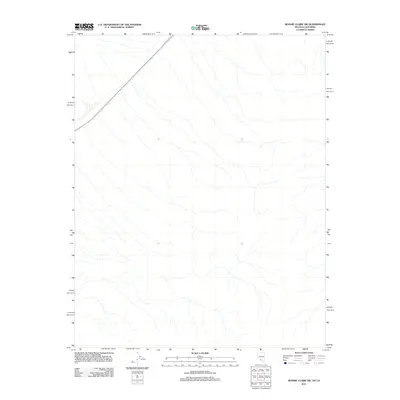
2011 Map of Bonnie Claire SW
USGS Topo · Published 2011About this map
The vast, arid expanse of Nye County, Nevada, dominates this terrain at the edge of the California border. A single prominent transit artery, 267, cuts diagonally across the northwestern corner of the landscape, providing the only paved access through this desert environment. The remainder of the quadrangle is defined by an intricate network of dry ephemeral drainage channels that score the alluvial fans, illustrating the natural hydrological patterns of the Great Basin. This specific survey captures the stark minimalism of the region before further modern developments, highlighting the isolation and the specific path of the highway relative to the surrounding topography.
Find a feature on this map
1 named feature on this map. Tap any name to fly to it.
Don’t see what you’re looking for? This feature index may not catch every label — zoom into the map to look around manually.
Map Details
Editions of this 2011 Bonnie Claire SW Map
This is the sole edition of this map. No revisions or reprints were ever made.
Other maps of this area

1908 · Lida
USGS Topo · 1:250,000

1908 · Ballarat
USGS Topo · 1:250,000

1913 · Lida
USGS Topo · 1:250,000

1913 · Ballarat
USGS Topo · 1:250,000

1948 · Death Valley
USGS Topo · 1:250,000

1954 · Death Valley
USGS Topo · 1:250,000

1954 · Goldfield
USGS Topo · 1:250,000

1955 · Goldfield
USGS Topo · 1:250,000

1956 · Death Valley
USGS Topo · 1:250,000

1957 · Death Valley
USGS Topo · 1:250,000