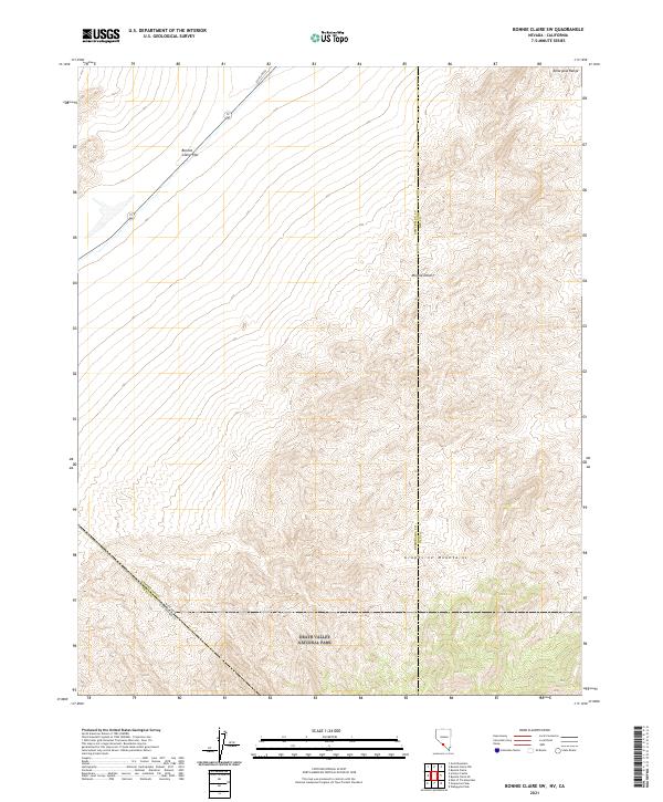
2021 Map of Bonnie Claire SW
USGS Topo · Published 2021About this map
Death Valley National Park anchors the southern portion of this high-desert survey, where the border between Nevada and California meets the rugged slopes of the Grapevine Mountains. This arid expanse transitions from the broad alkaline expanse of Bonnie Claire Flat in the northwest toward the northern reaches of the Mojave Desert. The landscape is defined by stark topographical shifts, tracing the elevation climb into the Amargosa Range at the northeastern corner. Infrastructure in this remote corridor is sparse, centered primarily on the straight path of Pole Line Rd, reflecting the era's utilitarian transport across the Great Basin. This map provides a clear record of the intersection between federal park lands and the county lines of Esmeralda and Nye counties, capturing a landscape shaped by tectonic movement and desert hydrology.
Find a feature on this map
16 named features on this map. Tap any name to fly to it.
Don’t see what you’re looking for? This feature index may not catch every label — zoom into the map to look around manually.
Map Details
Editions of this 2021 Bonnie Claire SW Map
This is the sole edition of this map. No revisions or reprints were ever made.
Other maps of this area

1908 · Lida
USGS Topo · 1:250,000

1908 · Ballarat
USGS Topo · 1:250,000

1913 · Lida
USGS Topo · 1:250,000

1913 · Ballarat
USGS Topo · 1:250,000

1948 · Death Valley
USGS Topo · 1:250,000

1954 · Death Valley
USGS Topo · 1:250,000

1954 · Goldfield
USGS Topo · 1:250,000

1955 · Goldfield
USGS Topo · 1:250,000

1956 · Death Valley
USGS Topo · 1:250,000

1957 · Death Valley
USGS Topo · 1:250,000