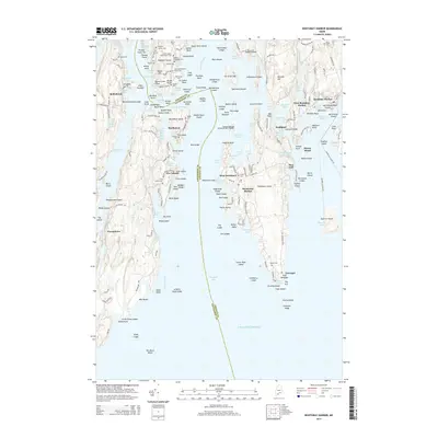
2014 Map of Boothbay Harbor
USGS Topo · Published 2014About this map
Westport Island and the rugged coastline of the Sheepscot River define this coastal Maine landscape, where numerous family cemeteries like Jewett Cem and Pierce Cem speak to deep-rooted maritime lineages. The map details the intricate waterways around Boothbay Harbor and Southport, including the navigable Townsend Gut and the protected waters of Ebenecook Harbor. Industrial and transportation history is evident at Mill Point and Railway Point, reflecting an era of shoreline commerce. From the small settlements of Five Islands and Robinhood to the larger harbor, the geography is a complex network of points, ledges, and islands such as MacMahan Island and Sawyer Island. This survey provides a precise account of the modern shoreline, tracking the roads and landmarks that have shaped these fishing and sailing communities into the 21st century.
Find a feature on this map
218 named features on this map. Tap any name to fly to it.
Don’t see what you’re looking for? This feature index may not catch every label — zoom into the map to look around manually.
Map Details
Editions of this 2014 Boothbay Harbor Map
This is the sole edition of this map. No revisions or reprints were ever made.
Other maps of this area

1893 · Small Point
USGS Topo · 1:62,500

1893 · Boothbay
USGS Topo · 1:62,500

1894 · Bath
USGS Topo · 1:62,500

1919 · Small Point
USGS Topo · 1:62,500

1920 · Bath
USGS Topo · 1:62,500

1941 · Boothbay
USGS Topo · 1:62,500

1943 · Boothbay
USGS Topo · 1:62,500

1944 · Boothbay
USGS Topo · 1:62,500

1944 · Small Point
USGS Topo · 1:62,500

1945 · Bath
USGS Topo · 1:62,500