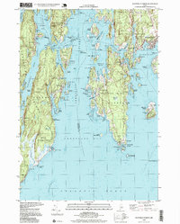
1997 Map of Boothbay Harbor
USGS Topo · Published 1999About this map
Boothbay Harbor serves as the focal point of this coastal survey, where the intricate geography of the Midcoast region is revealed through its complex network of islands and tidal inlets. The landscape is defined by long, north-south oriented peninsulas and protected harbors, including Southport and the smaller settlements of Newagen and Five Islands. The maritime character is evidenced by numerous navigational markers, most notably Lighthouse The Cuckolds guarding the southern approaches of the Sheepscot Bay.
Find a feature on this map
111 named features on this map. Tap any name to fly to it.
Don’t see what you’re looking for? This feature index may not catch every label — zoom into the map to look around manually.
Map Details
Editions of this 1997 Boothbay Harbor Map
This is the sole edition of this map. No revisions or reprints were ever made.
Other maps of this area

1893 · Small Point
USGS Topo · 1:62,500

1893 · Boothbay
USGS Topo · 1:62,500

1894 · Bath
USGS Topo · 1:62,500

1919 · Small Point
USGS Topo · 1:62,500

1920 · Bath
USGS Topo · 1:62,500

1941 · Boothbay
USGS Topo · 1:62,500

1943 · Boothbay
USGS Topo · 1:62,500

1944 · Boothbay
USGS Topo · 1:62,500

1944 · Small Point
USGS Topo · 1:62,500

1945 · Bath
USGS Topo · 1:62,500