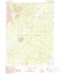
1990 Map of Border Mountain
USGS Topo · Published 1990About this map
Burnt Lava Flow Geological Area dominates the western edge of this Northern California landscape, where the volcanic heritage of the region is clearly etched in the terrain. Located within the Modoc National Forest, the area is characterized by distinct volcanic formations including Border Mountain, Buck Butte, and Round Mountain, the latter of which is topped by the Round Mountain Lookout. The volcanic geography dictates the presence of scarce water resources, noted by locations such as Frog Waterhole and Deep Waterhole.
Find a feature on this map
13 named features on this map. Tap any name to fly to it.
Don’t see what you’re looking for? This feature index may not catch every label — zoom into the map to look around manually.
Map Details
Editions of this 1990 Border Mountain Map
This is the sole edition of this map. No revisions or reprints were ever made.
Other maps of this area

1886 · Modoc Lava Bed
USGS Topo · 1:250,000

1892 · Modoc Lava-Bed
USGS Topo · 1:250,000

1932 · Bartle
USGS Topo · 1:96,000

1939 · Bartle
USGS Topo · 1:125,000

1952 · Timber Mountain
USGS Topo · 1:62,500

1952 · Medicine Lake
USGS Topo · 1:62,500

1954 · Alturas
USGS Topo · 1:250,000

1958 · Alturas
USGS Topo · 1:250,000

1961 · Hambone
USGS Topo · 1:62,500

1962 · Alturas
USGS Topo · 1:250,000