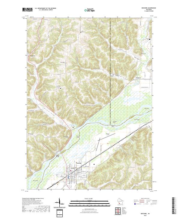
2022 Map of Boscobel
USGS Topo · Published 2022About this map
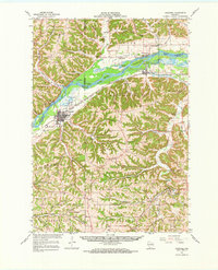
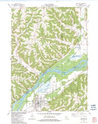
The Wisconsin River carves a broad valley through the center of this landscape, separating the rugged bluffs of Crawford and Richland Counties from the city of Boscobel to the south. This riverine geography is defined by a series of significant landforms including Feather Island, Trumbull Island, and Patterson Island, which mark the shifting channels of the waterway. On the northern banks, the terrain rises sharply into a network of ridges and hollows, where small settlements like Plugtown and Westport once served as local hubs. The map reveals a high density of family and community history preserved in the numerous upland burial grounds, such as Saint Patrick Cem and Union Steele Green Cem. These sites, along with landmarks like Easter Rock and Rattlesnake Point, indicate a landscape deeply settled and named by generations of residents who navigated the Marietta Valley and the steep gradients of Irish Ridge.
Find a feature on this map
98 named features on this map. Tap any name to fly to it.
Don’t see what you’re looking for? This feature index may not catch every label — zoom into the map to look around manually.
Map Details
Editions of this 2022 Boscobel Map
This is the sole edition of this map. No revisions or reprints were ever made.
Historical Maps of Plugtown Through Time
4 maps found