
Loading...
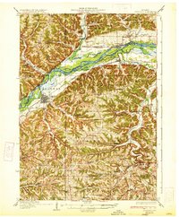
Loading map...1933 Map of Boscobel
USGS Topo · Published 1933About this map
Boscobel serves as the primary hub in this early 1930s survey, situated along the southern banks of the Wisconsin River. The landscape is defined by the sharp contrast between the wide, island-filled river valley and the deeply dissected ridges to the south. This era shows a remarkably dense network of rural infrastructure, with numerous one-room schoolhouses such as Campbell School and Gunderson School serving isolated hollows and ridge-top farms.
Find a feature on this map
85 named features on this map. Tap any name to fly to it.
Don’t see what you’re looking for? This feature index may not catch every label — zoom into the map to look around manually.
Map Details
Date Portrayed1933
Date Published1933
PublisherU.S. Geological Survey
Map TypeTopographic
Scale1:62,500
Physical Dimensions16.63 x 20.22 inches
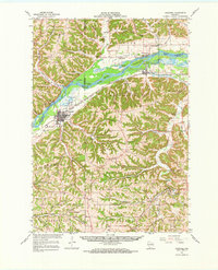
Editions of this 1933 Boscobel Map
2 editions found
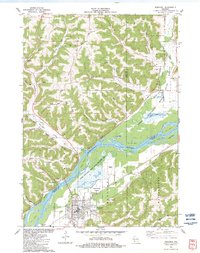
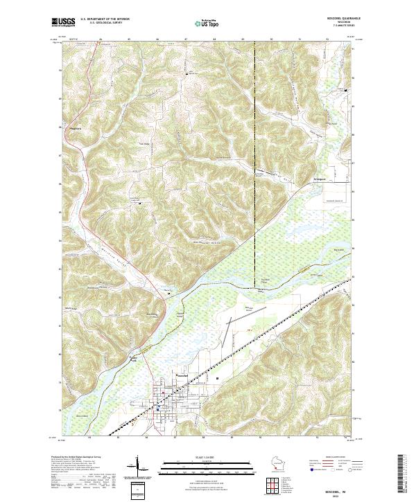
Historical Maps of Boscobel Through Time
4 maps found
Featured Locations
Source Details
SourceU.S. Geological Survey
CopyrightPublic Domain