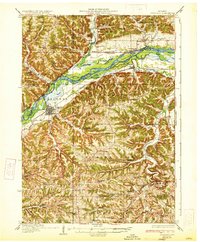
1933 Map of Boscobel
USGS Topo · Published 1933About this map
The Wisconsin River carves a wide path through this early 1930s landscape, flanked by a network of islands and sloughs such as Big I, Little I, and Jones Slough. Along the southern bank, the Chicago Milwaukee St Paul and Pacific railroad links the river towns of Boscobel and Blue River, while the northern bank features the smaller settlement of Port Andrew and the State Highway No 60 corridor.
Find a feature on this map
102 named features on this map. Tap any name to fly to it.
Don’t see what you’re looking for? This feature index may not catch every label — zoom into the map to look around manually.
Map Details
Editions of this 1933 Boscobel Map
2 editions found
Other maps of this area

1900 · Lancaster
USGS Topo · 1:125,000

1902 · Mineral Point
USGS Topo · 1:125,000

1904 · Lancaster
USGS Topo · 1:125,000

1905 · Richland Center
USGS Topo · 1:125,000

1908 · Lancaster
USGS Topo · 1:125,000

1924 · Gays Mills
USGS Topo · 1:62,500

1926 · Gays Mills
USGS Topo · 1:62,500

1926 · Wauzeka
USGS Topo · 1:62,500

1933 · Boaz
USGS Topo · 1:62,500

1933 · Boscobel
USGS Topo · 1:62,500