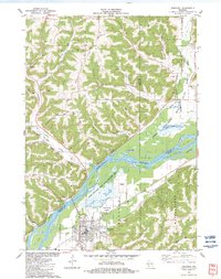
1983 Map of Boscobel
USGS Topo · Published 1983About this map
The Lower Wisconsin River serves as the dominant geographical feature of this 1980s landscape, weaving a complex network of islands including Trumbull Island, Feather Island, and Patterson Island. Along its southern bank, the city of Boscobel thrives at the junction of the Chicago Milwaukee St Paul and Pacific railroad and major road corridors. The map highlights a significant commitment to conservation and resource management through the Lower Wisconsin River State Wildlife Area and the State Forest Nursery, which occupy the broad river bottoms.
Find a feature on this map
54 named features on this map. Tap any name to fly to it.
Don’t see what you’re looking for? This feature index may not catch every label — zoom into the map to look around manually.
Map Details
Editions of this 1983 Boscobel Map
This is the sole edition of this map. No revisions or reprints were ever made.
Other maps of this area

1924 · Gays Mills
USGS Topo · 1:62,500

1926 · Gays Mills
USGS Topo · 1:62,500

1926 · Wauzeka
USGS Topo · 1:62,500

1933 · Boaz
USGS Topo · 1:62,500

1933 · Boscobel
USGS Topo · 1:62,500

1958 · La Crosse
USGS Topo · 1:250,000

1961 · La Crosse
USGS Topo · 1:250,000

1965 · La Crosse
USGS Topo · 1:250,000
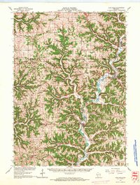
1966 · Gays Mills
USGS Topo · 1:62,500

1966 · Boaz
USGS Topo · 1:62,500