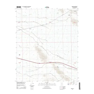
2014 Map of Bosque
USGS Topo · Published 2014About this map
Bosque sits at the heart of this desert landscape in the Sonoran region of Arizona, positioned along W Maricopa Rd. This 2014 survey reveals a sparse but significant network of human presence, notably the Bosque Cem located north of the primary road. The terrain is defined by the proximity of the Maricopa Mountains to the northeast and the Sand Tank Mountains to the south, with the drainage of Bender Wash cutting through the arid lowlands. To the north, the rail-aligned settlement of Shawmut marks a point of historical transit interest, while the western edge of the map begins to show the outskirts of Gila Bend. The distribution of these named points against the backdrop of the vast mountain ranges highlights the localized hubs of activity that have persisted in this corner of Maricopa County.
Find a feature on this map
14 named features on this map. Tap any name to fly to it.
Don’t see what you’re looking for? This feature index may not catch every label — zoom into the map to look around manually.
Map Details
Editions of this 2014 Bosque Map
This is the sole edition of this map. No revisions or reprints were ever made.
Other maps of this area

1951 · Estrella
USGS Topo · 1:62,500

1951 · Gila Bend
USGS Topo · 1:62,500

1951 · Mobile
USGS Topo · 1:62,500

1951 · Cotton Center
USGS Topo · 1:62,500

1953 · Ajo
USGS Topo · 1:250,000

1954 · Phoenix
USGS Topo · 1:250,000

1957 · Ajo
USGS Topo · 1:250,000

1957 · Phoenix
USGS Topo · 1:250,000

1958 · Ajo
USGS Topo · 1:250,000

1958 · Phoenix
USGS Topo · 1:250,000