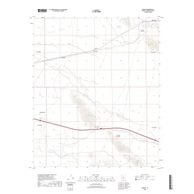
2018 Map of Bosque
USGS Topo · Published 2018About this map
The Maricopa Mountains and the Sand Tank Mountains define this arid landscape in southwestern Arizona, where the rail line and old highways dictated the pattern of local settlement. The community of Bosque serves as a focal point along the railroad, situated near the Bosque Cem and the ephemeral drainage of Bender Wash. To the northeast, the siding at Shawmut sits at the edge of the mountains, marking a remote stop in the high desert. Modern infrastructure is visible through the corridor of E Old 84 and the outskirts of Gila Bend, providing a clear record of how transportation routes have adapted to the terrain. This 2018 survey by the U.S. Geological Survey details the township and range lines across the T5S and T6S boundaries, capturing the area's transition between open desert flats and steep mountain slopes.
Find a feature on this map
14 named features on this map. Tap any name to fly to it.
Don’t see what you’re looking for? This feature index may not catch every label — zoom into the map to look around manually.
Map Details
Editions of this 2018 Bosque Map
This is the sole edition of this map. No revisions or reprints were ever made.
Other maps of this area

1951 · Estrella
USGS Topo · 1:62,500

1951 · Gila Bend
USGS Topo · 1:62,500

1951 · Mobile
USGS Topo · 1:62,500

1951 · Cotton Center
USGS Topo · 1:62,500

1953 · Ajo
USGS Topo · 1:250,000

1954 · Phoenix
USGS Topo · 1:250,000

1957 · Ajo
USGS Topo · 1:250,000

1957 · Phoenix
USGS Topo · 1:250,000

1958 · Ajo
USGS Topo · 1:250,000

1958 · Phoenix
USGS Topo · 1:250,000