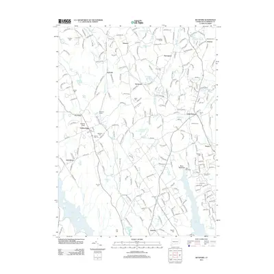
2012 Map of Botsford
USGS Topo · Published 2012About this map
Redding Ridge and Stepney anchor this 2012 survey, which highlights the dense network of small settlements and historical sites throughout the Greater Bridgeport region. The landscape is notably punctuated by numerous burial grounds, such as the Old Indian Cem and Tashua Burial Ground, providing a detailed record for genealogical research. Water management and infrastructure are central to the terrain, with both the Saugatuck Reservoir and Aspetuck Reservoir occupying significant portions of the southern quadrangle. The map captures a sophisticated suburban-rural interface where established villages like Palestine, Hattertown, and Sanfordtown sit alongside modern developments. Notable landmarks such as Flying Ridge Airstrip and Lakewood Camp indicate the area's varied land use, from residential and agricultural to recreational and utility-focused. The winding courses of the Aspetuck River and Pootatuck River define the local drainage patterns that historically influenced the placement of these early Connecticut towns.
Find a feature on this map
254 named features on this map. Tap any name to fly to it.
Don’t see what you’re looking for? This feature index may not catch every label — zoom into the map to look around manually.
Map Details
Editions of this 2012 Botsford Map
This is the sole edition of this map. No revisions or reprints were ever made.
Other maps of this area

1889 · Derby
USGS Topo · 1:62,500

1891 · Bridgeport
USGS Topo · 1:62,500

1891 · Derby
USGS Topo · 1:62,500

1892 · Danbury
USGS Topo · 1:62,500

1892 · Norwalk
USGS Topo · 1:62,500

1893 · Bridgeport
USGS Topo · 1:62,500

1893 · Norwalk
USGS Topo · 1:62,500

1893 · Derby
USGS Topo · 1:62,500

1915 · Danbury
USGS Topo · 1:62,500

1920 · Bridgeport
USGS Topo · 1:62,500