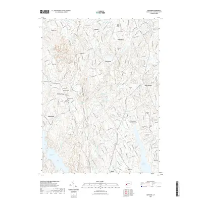
2021 Map of Botsford
USGS Topo · Published 2021About this map
Redding Ridge and the Aspetuck Valley define this Fairfield County landscape, where traditional rural settlements like Hattertown and Palestine remain visible among a network of historic burial grounds. The map preserves the locations of several significant local cemeteries, including the Old Indian Cem and the Tashua Burial Ground, providing essential data for genealogists and local historians. This era shows a complex hydrological system characterized by major catchments like the Saugatuck Reservoir and Easton Reservoir, alongside smaller bodies such as Mother Superior Lake and Hattertown Pond. Transportation history is evident in the Housatonic Rail Trl, while modern landmarks like the Flying Ridge Airstrip and the ATT Utility Line Trl cut across the hills of Sanfordtown and Upper Stepney. The terrain is marked by family-named landmarks including Meekers Hill and Tashua Hill, illustrating the enduring agricultural and residential footprint of the region.
Find a feature on this map
213 named features on this map. Tap any name to fly to it.
Don’t see what you’re looking for? This feature index may not catch every label — zoom into the map to look around manually.
Map Details
Editions of this 2021 Botsford Map
This is the sole edition of this map. No revisions or reprints were ever made.
Other maps of this area

1889 · Derby
USGS Topo · 1:62,500

1891 · Bridgeport
USGS Topo · 1:62,500

1891 · Derby
USGS Topo · 1:62,500

1892 · Danbury
USGS Topo · 1:62,500

1892 · Norwalk
USGS Topo · 1:62,500

1893 · Bridgeport
USGS Topo · 1:62,500

1893 · Norwalk
USGS Topo · 1:62,500

1893 · Derby
USGS Topo · 1:62,500

1915 · Danbury
USGS Topo · 1:62,500

1920 · Bridgeport
USGS Topo · 1:62,500