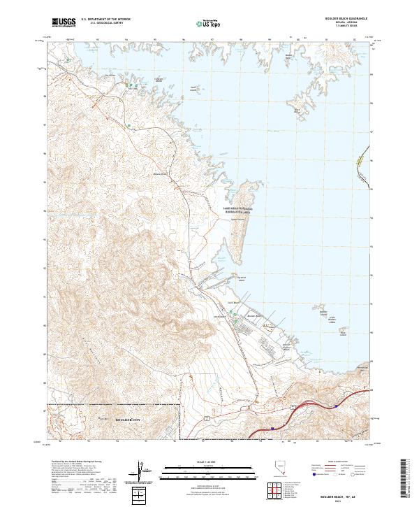
2021 Map of Boulder Beach
USGS Topo · Published 2021About this map
The rugged shoreline of Lake Mead and the northern reaches of Boulder City define this modern look at the Lake Mead National Recreation Area. The landscape is a study in the intersection of desert terrain and water management, where the Mojave Desert meets the deeply indented bays of Las Vegas Bay and Hemenway Harbor. The map highlights a significant outdoor infrastructure network, including the Historic Railroad Trl and the River Mountains Loop Trl, which follow the contours of the River Mountains and Black Mtn. Along the water, numerous recreational sites such as Boulder Beach, Swim Beach, and Boulder Harbor mark the transition from the arid uplands to the reservoir. Prominent island features like Saddle Island and Pyramid Island stand as landmarks within the basin, while the boundary between Clark County, Nevada, and Mohave County, Arizona, runs through the eastern waters.
Find a feature on this map
70 named features on this map. Tap any name to fly to it.
Don’t see what you’re looking for? This feature index may not catch every label — zoom into the map to look around manually.
Map Details
Editions of this 2021 Boulder Beach Map
This is the sole edition of this map. No revisions or reprints were ever made.
Other maps of this area

1886 · Camp Mohave
USGS Topo · 1:250,000

1886 · Saint Thomas
USGS Topo · 1:250,000

1892 · Camp Mohave
USGS Topo · 1:250,000

1893 · Saint Thomas
USGS Topo · 1:250,000

1926 · Nelson
USGS Topo · 1:96,000

1926 · Boulder Canyon
USGS Topo · 1:96,000

1942 · Camp Mohave
USGS Topo · 1:250,000

1947 · Kingman
USGS Topo · 1:250,000

1948 · Kingman
USGS Topo · 1:250,000

1952 · Henderson
USGS Topo · 1:62,500