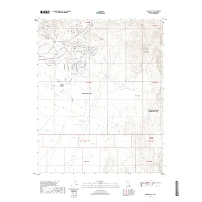
2018 Map of Boulder City
USGS Topo · Published 2018About this map
Boulder City sits at the heart of this desert landscape, its residential and industrial layout established between the River Mountains to the north and the Eldorado Mountains to the south. The map documents a community deeply integrated with its recreational and geological surroundings, showing a dense network of trails such as the Girl Scout Trail and the River Mountains Loop that navigate the slopes of Bootleg Canyon. To the east, the terrain descends into the Lake Mead National Recreation Area, where drainage systems like Hemenway Wash and South Fork Quail Wash carve through the Mojave Desert. The presence of the Boulder City Municipal Airport and numerous named streets like Adams Blvd and Buchanan Blvd highlight the city's modern infrastructure amidst high-relief landmarks like The Knoll and Camp Knob.
Find a feature on this map
90 named features on this map. Tap any name to fly to it.
Don’t see what you’re looking for? This feature index may not catch every label — zoom into the map to look around manually.
Map Details
Editions of this 2018 Boulder City Map
This is the sole edition of this map. No revisions or reprints were ever made.
Other maps of this area

1886 · Camp Mohave
USGS Topo · 1:250,000

1886 · Saint Thomas
USGS Topo · 1:250,000

1892 · Camp Mohave
USGS Topo · 1:250,000

1893 · Saint Thomas
USGS Topo · 1:250,000

1926 · Nelson
USGS Topo · 1:96,000

1926 · Boulder Canyon
USGS Topo · 1:96,000

1942 · Camp Mohave
USGS Topo · 1:250,000

1947 · Kingman
USGS Topo · 1:250,000

1948 · Kingman
USGS Topo · 1:250,000

1952 · Henderson
USGS Topo · 1:62,500