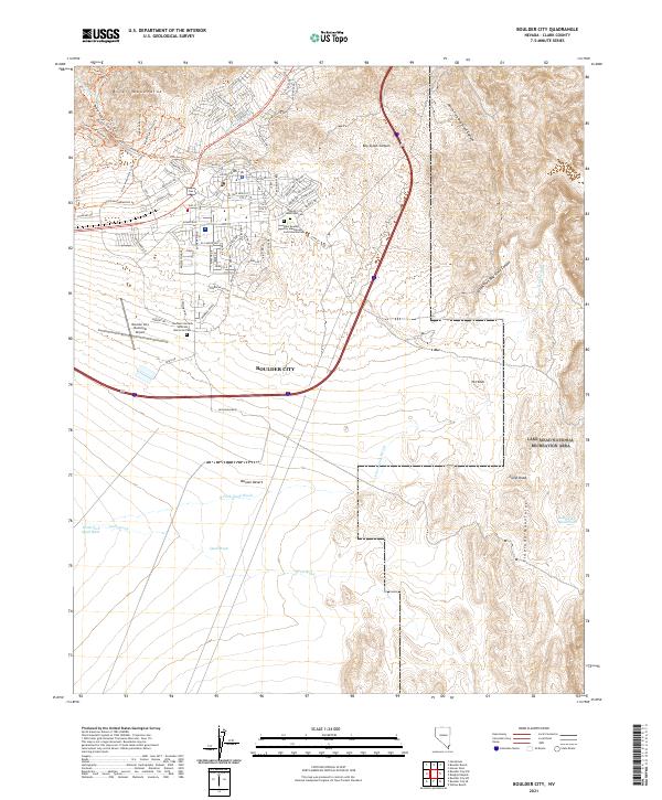
2021 Map of Boulder City
USGS Topo · Published 2021About this map
Boulder City serves as the focal point of this Nevada landscape, positioned on a high plateau between the River Mountains to the north and the Eldorado Mountains to the south. The city's organized street grid, including Adams Blvd and Buchanan Blvd, transitions into a dense network of recreational paths like the River Mountains Loop Trl and Upper Lake View Trl, reflecting the area's modern identity as a gateway for outdoor enthusiasts. This 2021 survey illustrates how the settlement manages its desert environment, with Hemenway Wash and Quail Wash carving drainage paths through the Mojave Desert floor.
Find a feature on this map
91 named features on this map. Tap any name to fly to it.
Don’t see what you’re looking for? This feature index may not catch every label — zoom into the map to look around manually.
Map Details
Editions of this 2021 Boulder City Map
This is the sole edition of this map. No revisions or reprints were ever made.
Other maps of this area

1886 · Camp Mohave
USGS Topo · 1:250,000

1886 · Saint Thomas
USGS Topo · 1:250,000

1892 · Camp Mohave
USGS Topo · 1:250,000

1893 · Saint Thomas
USGS Topo · 1:250,000

1926 · Nelson
USGS Topo · 1:96,000

1926 · Boulder Canyon
USGS Topo · 1:96,000

1942 · Camp Mohave
USGS Topo · 1:250,000

1947 · Kingman
USGS Topo · 1:250,000

1948 · Kingman
USGS Topo · 1:250,000

1952 · Henderson
USGS Topo · 1:62,500