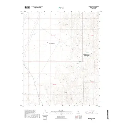
2018 Map of Boulder City SE
USGS Topo · Published 2018About this map
Boulder City serves as the gateway to this arid landscape in Clark County, where the transition from the level expanse of the Eldorado Valley meets the sharp relief of the Eldorado Mountains. This 2018 survey documents a region defined by its desert hydrology and high-contrast topography, featuring landmarks such as the Pilot Cone and the winding course of Quail Wash. The map details the western reaches of the Lake Mead National Recreation Area, providing a precise record of public lands and topographical features at the edge of the Mojave Desert. Local history researchers can identify specific water sources like Forlorn Hope Spring and Davis Spring, which were vital markers in this dry environment. The presence of Oak Creek Canyon and Lonesome Wash further illustrates the complex drainage patterns that shape the terrain south of the city.
Find a feature on this map
15 named features on this map. Tap any name to fly to it.
Don’t see what you’re looking for? This feature index may not catch every label — zoom into the map to look around manually.
Map Details
Editions of this 2018 Boulder City SE Map
This is the sole edition of this map. No revisions or reprints were ever made.
Other maps of this area

1886 · Camp Mohave
USGS Topo · 1:250,000

1892 · Camp Mohave
USGS Topo · 1:250,000

1926 · Nelson
USGS Topo · 1:96,000

1942 · Camp Mohave
USGS Topo · 1:250,000

1947 · Kingman
USGS Topo · 1:250,000

1948 · Kingman
USGS Topo · 1:250,000

1954 · Kingman
USGS Topo · 1:250,000

1955 · Kingman
USGS Topo · 1:250,000

1958 · Kingman
USGS Topo · 1:250,000
1958 · Boulder City SW
USGS Topo · 1:24,000