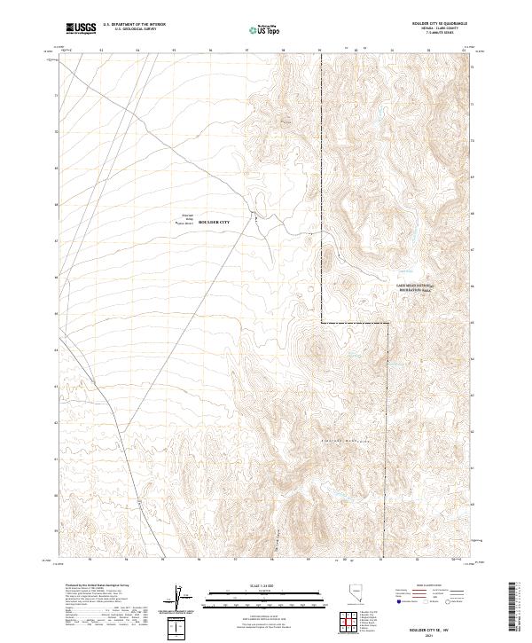
2021 Map of Boulder City SE
USGS Topo · Published 2021About this map
The Eldorado Mountains dominate the southern half of this landscape, where the arid terrain is carved by steep drainages like Oak Creek Canyon and the evocatively named Lonesome Wash. This section of the Mojave Desert serves as a transition between the high desert peaks and the vast desert floor of Eldorado Valley. Notable landmarks include Pilot Cone, a distinct high point that likely served as a navigational aid in this expansive environment.
Find a feature on this map
15 named features on this map. Tap any name to fly to it.
Don’t see what you’re looking for? This feature index may not catch every label — zoom into the map to look around manually.
Map Details
Editions of this 2021 Boulder City SE Map
This is the sole edition of this map. No revisions or reprints were ever made.
Other maps of this area

1886 · Camp Mohave
USGS Topo · 1:250,000

1892 · Camp Mohave
USGS Topo · 1:250,000

1926 · Nelson
USGS Topo · 1:96,000

1942 · Camp Mohave
USGS Topo · 1:250,000

1947 · Kingman
USGS Topo · 1:250,000

1948 · Kingman
USGS Topo · 1:250,000

1954 · Kingman
USGS Topo · 1:250,000

1955 · Kingman
USGS Topo · 1:250,000

1958 · Kingman
USGS Topo · 1:250,000
1958 · Boulder City SW
USGS Topo · 1:24,000