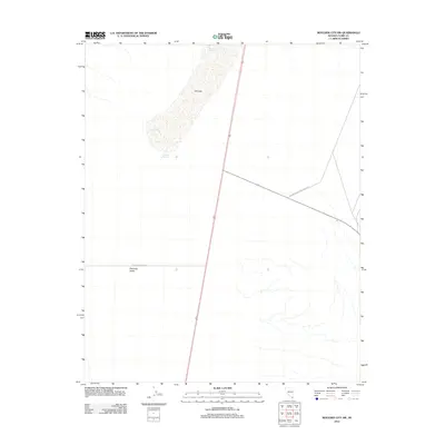
2012 Map of Boulder City SW
USGS Topo · Published 2012About this map
Eldorado Valley dominates this 2012 survey, revealing a landscape defined by desert hydrology and public recreation management southwest of Boulder City. The central feature is the extensive Dry Lake basin, which serves as a natural catchment area for seasonal runoff. This arid geography is further managed through a series of water control features including the Murshe Reservoir, C C C Reservoir, and Dry Lake Reservoir, illustrating the critical role of water infrastructure in the Nevada desert. The eastern portion of the map transitions into the protected lands of the Lake Mead National Rec Area, showing the intersection of open basin terrain and federally managed conservation zones. A single primary thoroughfare, Eldorado Valley Dr, provides the main access point across this expanse, marking the light human footprint on this high-desert environment during the early 21st century.
Find a feature on this map
7 named features on this map. Tap any name to fly to it.
Don’t see what you’re looking for? This feature index may not catch every label — zoom into the map to look around manually.
Map Details
Editions of this 2012 Boulder City SW Map
This is the sole edition of this map. No revisions or reprints were ever made.
Other maps of this area

1886 · Camp Mohave
USGS Topo · 1:250,000

1892 · Camp Mohave
USGS Topo · 1:250,000

1910 · Ivanpah
USGS Topo · 1:250,000

1912 · Ivanpah
USGS Topo · 1:250,000

1926 · Nelson
USGS Topo · 1:96,000

1942 · Camp Mohave
USGS Topo · 1:250,000

1942 · Ivanpah
USGS Topo · 1:250,000

1947 · Kingman
USGS Topo · 1:250,000

1948 · Kingman
USGS Topo · 1:250,000

1954 · Kingman
USGS Topo · 1:250,000