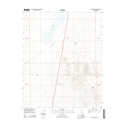
2014 Map of Boulder City SW
USGS Topo · Published 2014About this map
The Mojave Desert terrain south of Boulder City is defined by the stark contrast between the Eldorado Valley floor and the rising slopes of the Eldorado Mountains. In the north-central portion of the quadrangle, ephemeral water features such as Dry Lake, Mursha Reservoir, and Dry Lake Reservoir indicate the basin's drainage patterns. This 2014 survey records a landscape shaped by both natural topography and transportation infrastructure, including the passage of Nv-165 and Eldorado Valley Dr. The map also traces McCullough Pass, a route through the highland area that highlights the traditional paths taken through this arid region. This specific quadrangle captures the interplay of high-desert basins and mountain ridges just before significant modern developments began to further alter the valley's character.
Find a feature on this map
15 named features on this map. Tap any name to fly to it.
Don’t see what you’re looking for? This feature index may not catch every label — zoom into the map to look around manually.
Map Details
Editions of this 2014 Boulder City SW Map
This is the sole edition of this map. No revisions or reprints were ever made.
Other maps of this area

1886 · Camp Mohave
USGS Topo · 1:250,000

1892 · Camp Mohave
USGS Topo · 1:250,000

1910 · Ivanpah
USGS Topo · 1:250,000

1912 · Ivanpah
USGS Topo · 1:250,000

1926 · Nelson
USGS Topo · 1:96,000

1942 · Camp Mohave
USGS Topo · 1:250,000

1942 · Ivanpah
USGS Topo · 1:250,000

1947 · Kingman
USGS Topo · 1:250,000

1948 · Kingman
USGS Topo · 1:250,000

1954 · Kingman
USGS Topo · 1:250,000