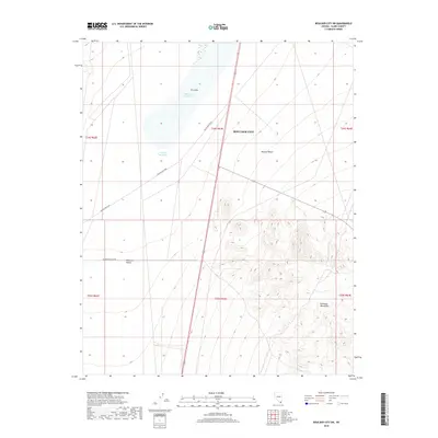
2018 Map of Boulder City SW
USGS Topo · Published 2018About this map
The Mojave Desert terrain of southern Nevada defines this 2018 survey, centered on the broad expanse of the Eldorado Valley. The landscape is dominated by ephemeral water features, including Dry Lake and the associated Mursha Reservoir and Dry Lake Reservoir, which illustrate the arid drainage patterns of the region. To the southeast, the topography rises sharply into the Eldorado Mountains, creating a stark contrast to the level valley floor. Transportation through this desert environment is marked by McCullough Pass, a traditional route through the surrounding heights, and Eldorado Valley Dr. The map reflects the land management and resource preservation within the Boulder City boundaries, showing a region where natural desert landforms remain largely undisturbed by dense urban development.
Find a feature on this map
15 named features on this map. Tap any name to fly to it.
Don’t see what you’re looking for? This feature index may not catch every label — zoom into the map to look around manually.
Map Details
Editions of this 2018 Boulder City SW Map
This is the sole edition of this map. No revisions or reprints were ever made.
Other maps of this area

1886 · Camp Mohave
USGS Topo · 1:250,000

1892 · Camp Mohave
USGS Topo · 1:250,000

1910 · Ivanpah
USGS Topo · 1:250,000

1912 · Ivanpah
USGS Topo · 1:250,000

1926 · Nelson
USGS Topo · 1:96,000

1942 · Camp Mohave
USGS Topo · 1:250,000

1942 · Ivanpah
USGS Topo · 1:250,000

1947 · Kingman
USGS Topo · 1:250,000

1948 · Kingman
USGS Topo · 1:250,000

1954 · Kingman
USGS Topo · 1:250,000