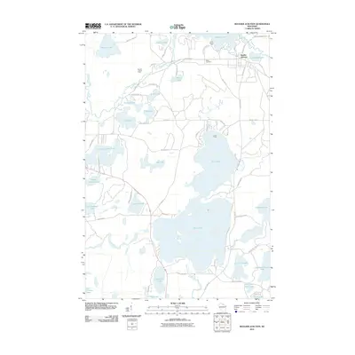
2010 Map of Boulder Junction
USGS Topo · Published 2010About this map
Boulder Junction serves as the primary hub in this northern Wisconsin lake district, where the Manitowish River flows through a landscape defined by glacial activity. The massive footprint of Trout Lake dominates the central terrain, surrounded by specialized enclaves such as Camp Manito-wish and Camp Fiesta. The settlement pattern follows the intricate shoreline of dozens of smaller water bodies, including Upper Gresham Lake, Little Rice Lake, and Allequash Lake.
Find a feature on this map
63 named features on this map. Tap any name to fly to it.
Don’t see what you’re looking for? This feature index may not catch every label — zoom into the map to look around manually.
Map Details
Editions of this 2010 Boulder Junction Map
This is the sole edition of this map. No revisions or reprints were ever made.
Other maps of this area

1938 · Minocqua
USGS Topo · 1:48,000

1938 · Lac Du Flambeau
USGS Topo · 1:48,000

1939 · Trout Lake
USGS Topo · 1:48,000

1939 · Lac Du Flambeau
USGS Topo · 1:48,000

1939 · Winchester
USGS Topo · 1:48,000

1946 · Winchester
USGS Topo · 1:48,000

1946 · Minocqua
USGS Topo · 1:48,000

1946 · Lac Du Flambeau
USGS Topo · 1:48,000

1946 · Trout Lake
USGS Topo · 1:48,000

1949 · Trout Lake
USGS Topo · 1:48,000