
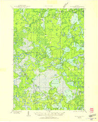
1939 Map of Winchester
USGS Topo · Published 1939About this map
Glacial lakes and wetlands dominate the landscape of Vilas and Iron counties in the late 1930s, reflecting a period of conservation and early tourism in the Northern Highland State Forest. The presence of a CCC Camp near Winchester and the Rest Lake Fire Tower No 51 highlights the New Deal era labor and fire protection infrastructure that shaped these Northwoods. While the Chicago and Northwestern railroad skirts the northeastern corner, the interior is connected by a growing network of fire lanes and trunk highways. Small rural institutions such as Spider Lake Sch and Birch Lake Sch served the scattered populations near Manitowish and Powell. Local landmarks like Shay Dam on the Turtle River and the Winegar Cem provide specific points of interest for genealogists and local historians tracking early settlement and industry.
Find a feature on this map
127 named features on this map. Tap any name to fly to it.
Don’t see what you’re looking for? This feature index may not catch every label — zoom into the map to look around manually.
Map Details
Editions of this 1939 Winchester Map
2 editions found
Other maps of this area

1938 · Minocqua
USGS Topo · 1:48,000

1938 · Lac Du Flambeau
USGS Topo · 1:48,000

1939 · Trout Lake
USGS Topo · 1:48,000

1939 · Lac Du Flambeau
USGS Topo · 1:48,000

1940 · Mercer
USGS Topo · 1:48,000

1941 · Pike Lake
USGS Topo · 1:48,000

1942 · Pike Lake
USGS Topo · 1:48,000

1943 · Ironwood
USGS Topo · 1:48,000

1945 · Mercer
USGS Topo · 1:48,000

1946 · Winchester
USGS Topo · 1:48,000