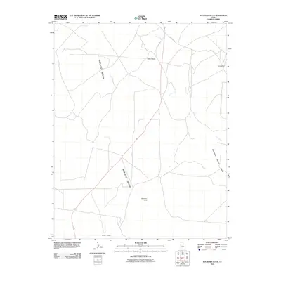
2010 Map of Boundary Butte
USGS Topo · Published 2010About this map
The North Boundary Butte Oil Field anchors the northeastern corner of this high-desert landscape in the Shiprock Agency region, signaling the area's modern industrial footprint. The terrain is defined by broad plateaus and mesas, most notably the Nokaito Bench which dominates the central portion of the map, and the prominent Boundary Butte Mesa to the east. Transportation through this arid environment relies on a network of tribal and local routes, including the prominent Mexican Water Rd and various Indian Routes like Indian Rte 5060. This 2010 survey illustrates the sparsely populated nature of the region, where named landmarks like Little Water and Boundary Butte provide essential orientation in a landscape carved by the seasonal path of Gothic Creek. The presence of the oil field alongside traditional place names reflects the ongoing balance between natural landforms and mineral resource extraction.
Find a feature on this map
13 named features on this map. Tap any name to fly to it.
Don’t see what you’re looking for? This feature index may not catch every label — zoom into the map to look around manually.
Map Details
Editions of this 2010 Boundary Butte Map
This is the sole edition of this map. No revisions or reprints were ever made.
Other maps of this area

1886 · Abajo
USGS Topo · 1:250,000

1892 · Abajo
USGS Topo · 1:250,000

1892 · Canyon De Chelly
USGS Topo · 1:250,000

1893 · Abajo
USGS Topo · 1:250,000

1953 · Dinne Mesa NW
USGS Topo · 1:24,000

1953 · Toh-Atin Mesa
USGS Topo · 1:62,500

1954 · Shiprock
USGS Topo · 1:250,000

1956 · Cortez
USGS Topo · 1:250,000

1958 · Cortez
USGS Topo · 1:250,000

1958 · Shiprock
USGS Topo · 1:250,000