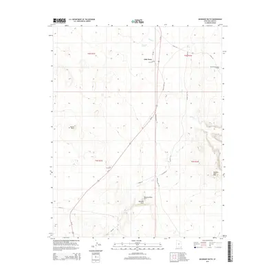
2014 Map of Boundary Butte
USGS Topo · Published 2014About this map
Little Water sits as a primary point of reference in this arid landscape, where the high desert terrain is defined by dramatic geologic formations. The area is anchored by the Boundary Butte uplift, a region featuring the Boundary Butte Arch and the expansive Boundary Butte Mesa. Significant industrial activity is noted at the North Boundary Butte Oil Field near the northern edge of the sheet, reflecting the long-standing extraction history of the San Juan Basin. Reliable water sources are scarce but critical in this environment, represented by named sites such as Tohanadli Spring, Salt Spring, and Sand Spring. Modern infrastructure is visible through the corridor of Us-191, which cuts diagonally across the quadrangle, intersecting local routes like Mexican Water Rd and Boundary Butte Rd that connect remote settlements and resource extraction sites.
Find a feature on this map
28 named features on this map. Tap any name to fly to it.
Don’t see what you’re looking for? This feature index may not catch every label — zoom into the map to look around manually.
Map Details
Editions of this 2014 Boundary Butte Map
This is the sole edition of this map. No revisions or reprints were ever made.
Other maps of this area

1886 · Abajo
USGS Topo · 1:250,000

1892 · Abajo
USGS Topo · 1:250,000

1892 · Canyon De Chelly
USGS Topo · 1:250,000

1893 · Abajo
USGS Topo · 1:250,000

1953 · Dinne Mesa NW
USGS Topo · 1:24,000

1953 · Toh-Atin Mesa
USGS Topo · 1:62,500

1954 · Shiprock
USGS Topo · 1:250,000

1956 · Cortez
USGS Topo · 1:250,000

1958 · Cortez
USGS Topo · 1:250,000

1958 · Shiprock
USGS Topo · 1:250,000