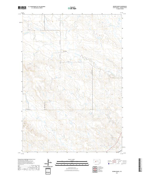
2021 Map of Bowen Ranch
USGS Topo · Published 2021About this map
Bowen Ranch serves as the primary named landmark in this expanse of Haakon County, situated near the meandering path of the N Fork Bad River. The landscape is defined by its drainage systems, including the notable northern flow of Deadmans Cr and the eastern stretch of Mexican Cr near the township lines. A grid of section-line roads, such as 213th Ave and 229th St, provides access across the various townships, including t2n r19e and t1n r19e. The hydrology of the area is further characterized by the presence of Dry Cr in the southwest, illustrating the typical intermittent water patterns of the South Dakota prairie during this modern era. The road network, featuring E Grindstone Rd, connects the ranching property to the broader region, maintaining the traditional cattle-country infrastructure that has shaped this part of the state for generations.
Find a feature on this map
18 named features on this map. Tap any name to fly to it.
Don’t see what you’re looking for? This feature index may not catch every label — zoom into the map to look around manually.
Map Details
Editions of this 2021 Bowen Ranch Map
This is the sole edition of this map. No revisions or reprints were ever made.
Other maps of this area

1953 · Philip Junction
USGS Topo · 1:24,000

1953 · Philip
USGS Topo · 1:24,000

1954 · Pierre
USGS Topo · 1:250,000

1955 · Martin
USGS Topo · 1:250,000

1958 · Pierre
USGS Topo · 1:250,000

1958 · Martin
USGS Topo · 1:250,000

1961 · Cottonwood
USGS Topo · 1:24,000

1961 · Cottonwood NE
USGS Topo · 1:24,000

1980 · Kadoka
USGS Topo · 1:100,000

1983 · Philip
USGS Topo · 1:100,000