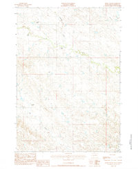
1983 Map of Bowen Ranch
USGS Topo · Published 1984About this map
Isolated homesteads and the drainage basins of western South Dakota define this high plains landscape in Haakon County. Family-named outposts such as Gottlieben Ranch, Poss Ranch, and Bowen Ranch anchor the ranching culture of the region, situated along the winding course of the North Fork Bad River. The topography is etched by seasonal watercourses like Deadmans Creek, Mexican Creek, and Dry Creek, which illustrate the rugged drainage patterns typical of the state's prairie interior. In the southeastern corner, the presence of the C & N W railroad line and a double wood pole transmission line signal the infrastructure supporting this expansive ranching territory. This 1980s survey provides a clear look at the spatial distribution of these remote holdings and their proximity to the forks of the Bad River.
Find a feature on this map
13 named features on this map. Tap any name to fly to it.
Don’t see what you’re looking for? This feature index may not catch every label — zoom into the map to look around manually.
Map Details
Editions of this 1983 Bowen Ranch Map
This is the sole edition of this map. No revisions or reprints were ever made.
Other maps of this area

1953 · Philip Junction
USGS Topo · 1:24,000

1953 · Philip
USGS Topo · 1:24,000

1954 · Pierre
USGS Topo · 1:250,000

1955 · Martin
USGS Topo · 1:250,000

1958 · Pierre
USGS Topo · 1:250,000

1958 · Martin
USGS Topo · 1:250,000

1961 · Cottonwood
USGS Topo · 1:24,000

1961 · Cottonwood NE
USGS Topo · 1:24,000

1980 · Kadoka
USGS Topo · 1:100,000

1983 · Philip
USGS Topo · 1:100,000