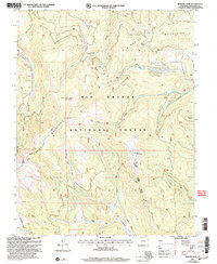
2001 Map of Bowers Peak
USGS Topo · Published 2005About this map
The La Garita Mountains dominate this high-altitude reach of the Rio Grande National Forest, where the landscape is defined by the sharp divide of the Saguache District. High points like Bowers Peak and Boot Mountain overlook a complex network of drainages including Miners Creek and California Gulch. This 2001 revision illustrates the enduring infrastructure of high-country ranching and resource management, prominently featuring the Laughlin Stock Driveway used for moving livestock between seasonal pastures. The map also records numerous 4WD tracks and trails that navigate through the steep terrain, crossing the Saguache Divide at points like Moon Pass. Dozens of smaller watercourses, such as South Fork Carnero Creek and Geban Creek, reveal the intricate watershed patterns that feed the larger valleys below.
Find a feature on this map
25 named features on this map. Tap any name to fly to it.
Don’t see what you’re looking for? This feature index may not catch every label — zoom into the map to look around manually.
Map Details
Editions of this 2001 Bowers Peak Map
This is the sole edition of this map. No revisions or reprints were ever made.
Other maps of this area

1914 · Creede
USGS Topo · 1:125,000

1915 · Del Norte
USGS Topo · 1:125,000

1916 · Creede
USGS Topo · 1:125,000

1917 · Del Norte
USGS Topo · 1:125,000

1945 · Durango
USGS Topo · 1:250,000

1953 · Durango
USGS Topo · 1:250,000

1954 · Durango
USGS Topo · 1:250,000

1956 · Montrose
USGS Topo · 1:250,000

1959 · Montrose
USGS Topo · 1:250,000

1960 · Montrose
USGS Topo · 1:250,000