2022 Map of Bowie
USGS Topo · Published 2022About this map
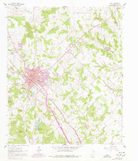
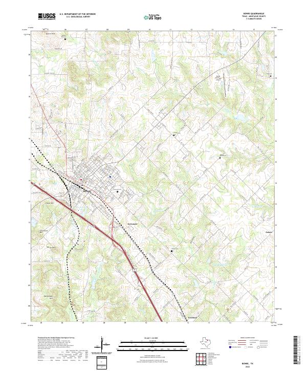
Bowie serves as the central hub of this Montague County landscape, where the grid of the town site meets the diagonal path of the Burlington Northern Santa Fe railroad. The surrounding terrain is marked by a series of prominent elevations, including Queens Peak to the north and a cluster of peaks to the southwest such as Cougar Mtn, Grindstone Mtn, and Rattlesnake Mtn. This topographic character influences the drainage patterns of Victoria Cr and Denton Cr as they move through the countryside.
Find a feature on this map
132 named features on this map. Tap any name to fly to it.
Don’t see what you’re looking for? This feature index may not catch every label — zoom into the map to look around manually.
Map Details
Editions of this 2022 Bowie Map
This is the sole edition of this map. No revisions or reprints were ever made.