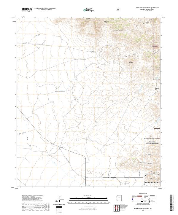
2021 Map of Bowie Mountain South
USGS Topo · Published 2021About this map
The Chiricahua Mountains dominate this landscape of the eastern Arizona desert, where high peaks like Bowie Mtn and Red Mtn rise above deep drainage systems such as Maverick Canyon and Anderson Canyon. This modern survey records the transition between the managed lands of the Coronado National Forest and the protected wilderness of the Chiricahua National Monument. Local ranching history is evidenced by a network of private access points including Red Wine Ranch Rd and S Rancho Sierra Rd. Genealogy researchers can identify several small burial sites tucked into the terrain, including Riggs Cem, Erickson Cem, and the Neighborhood Cem. Water sources are vital in this arid environment, marked here by The Comet Spring and the intermittent flows of Pine Cr and Little Sand Wash.
Find a feature on this map
36 named features on this map. Tap any name to fly to it.
Don’t see what you’re looking for? This feature index may not catch every label — zoom into the map to look around manually.
Map Details
Editions of this 2021 Bowie Mountain South Map
This is the sole edition of this map. No revisions or reprints were ever made.
Other maps of this area

1916 · Pearce
USGS Topo · 1:125,000

1917 · San Simon
USGS Topo · 1:125,000

1917 · Chiricahua
USGS Topo · 1:125,000

1919 · Chiricahua
USGS Topo · 1:125,000

1922 · Willcox
USGS Topo · 1:125,000

1926 · Light
USGS Topo · 1:62,500

1926 · Cochise Head
USGS Topo · 1:62,500

1926 · Rucker
USGS Topo · 1:62,500

1943 · Dos Cabezas
USGS Topo · 1:62,500

1950 · Cochise Head
USGS Topo · 1:62,500