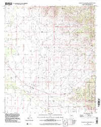
1996 Map of Bowie Mountain South
USGS Topo · Published 2002About this map
Riggs Home Ranch and the nearby Riggs Cem anchor the lower drainage of Pinery Creek, reflecting the deep-rooted ranching history of Cochise County. The landscape is defined by the transition from the high ridges of the Chiricahua Mountains and peaks like Bowie Mountain down to the alluvial fans and washes of the basin. The map clearly delineates the Old Military Reservation Boundary and the edges of the Chiricahua National Monument, highlighting the complex overlay of federal land management and private holdings.
Find a feature on this map
37 named features on this map. Tap any name to fly to it.
Don’t see what you’re looking for? This feature index may not catch every label — zoom into the map to look around manually.
Map Details
Editions of this 1996 Bowie Mountain South Map
This is the sole edition of this map. No revisions or reprints were ever made.
Other maps of this area

1916 · Pearce
USGS Topo · 1:125,000

1917 · San Simon
USGS Topo · 1:125,000

1917 · Chiricahua
USGS Topo · 1:125,000

1919 · Chiricahua
USGS Topo · 1:125,000

1922 · Willcox
USGS Topo · 1:125,000

1926 · Light
USGS Topo · 1:62,500

1926 · Cochise Head
USGS Topo · 1:62,500

1926 · Rucker
USGS Topo · 1:62,500

1943 · Dos Cabezas
USGS Topo · 1:62,500

1950 · Cochise Head
USGS Topo · 1:62,500