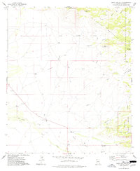
1974 Map of Bowie Mtn South
USGS Topo · Published 1977About this map
Riggs Home Ranch and its nearby Riggs Cem anchor the western slopes of the Chiricahua Mountains in this mid-1970s topographic study. The landscape is defined by the sharp transition from the desert basin of Big Sand Wash and Little Sand Wash to the high, complex drainages of the Coronado National Forest. Notable markers of the frontier past are evident in the Old Military Reservation Boundary and the presence of several burial grounds, including a generic Cem and the Neighborhood Cem located near the El Dorado Sch.
Find a feature on this map
34 named features on this map. Tap any name to fly to it.
Don’t see what you’re looking for? This feature index may not catch every label — zoom into the map to look around manually.
Map Details
Editions of this 1974 Bowie Mtn South Map
This is the sole edition of this map. No revisions or reprints were ever made.
Other maps of this area

1916 · Pearce
USGS Topo · 1:125,000

1917 · San Simon
USGS Topo · 1:125,000

1917 · Chiricahua
USGS Topo · 1:125,000

1919 · Chiricahua
USGS Topo · 1:125,000

1922 · Willcox
USGS Topo · 1:125,000

1926 · Light
USGS Topo · 1:62,500

1926 · Cochise Head
USGS Topo · 1:62,500

1926 · Rucker
USGS Topo · 1:62,500

1943 · Dos Cabezas
USGS Topo · 1:62,500

1950 · Cochise Head
USGS Topo · 1:62,500