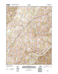
2013 Map of Boyce
USGS Topo · Published 2013About this map
The Shenandoah River snakes through the eastern portion of this quadrangle, defining a landscape marked by established equestrian farms and named estates. Centered on the communities of Boyce and White Post, the region reflects a legacy of significant landholdings such as Tuleyries Estate, Pagebrook Estate, and Rosney Estate. The pattern of development follows old road networks and watercourses, with Morgan Mill and the historic Stone Bridge serving as local landmarks along the creeks feeding the river.
Find a feature on this map
187 named features on this map. Tap any name to fly to it.
Don’t see what you’re looking for? This feature index may not catch every label — zoom into the map to look around manually.
Map Details
Editions of this 2013 Boyce Map
This is the sole edition of this map. No revisions or reprints were ever made.
Other maps of this area

1884 · Harpers Ferry
USGS Topo · 1:125,000

1891 · Harpers Ferry
USGS Topo · 1:125,000

1893 · Luray
USGS Topo · 1:125,000

1893 · Harpers Ferry
USGS Topo · 1:125,000

1894 · Warrenton
USGS Topo · 1:125,000

1894 · Winchester
USGS Topo · 1:125,000

1905 · Luray
USGS Topo · 1:125,000

1916 · Berryville
USGS Topo · 1:62,500

1938 · Winchester
USGS Topo · 1:48,000

1939 · Front Royal
USGS Topo · 1:48,000