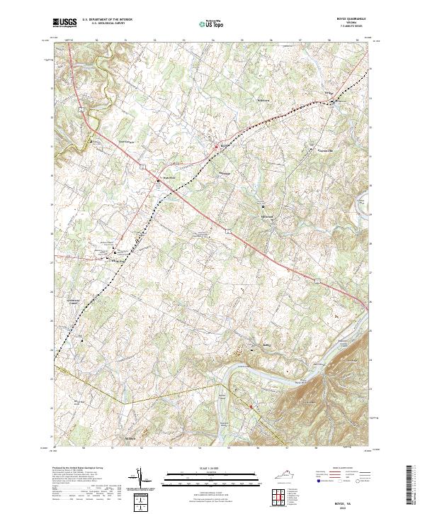
2022 Map of Boyce
USGS Topo · Published 2022About this map
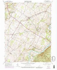
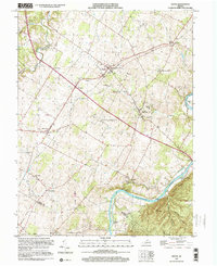
The Shenandoah River winds through the southeastern corner of this Clarke County landscape, defining the terrain near Hardin Island and Treasure Island. The area is characterized by long-established agricultural lands and small, historic crossroads. In White Post, the Meade Memorial Episcopal Church Cem and Ebenezer Baptist Church Cem reflect the community's deep roots, while the University of Virginia Blandy Experimental Farm represents the region's ongoing dedication to agricultural research. Small family burial sites, such as the Trenary Family Cem and Dearmont Farm Cem, are scattered across the valley, offering significant detail for genealogical research. Settlement patterns follow the old pikes and runs, connecting places like Millwood, Boyce, and White Oak Level through a network of historic roads and watercourses including Spout Run and Westbrook Run.
Find a feature on this map
144 named features on this map. Tap any name to fly to it.
Don’t see what you’re looking for? This feature index may not catch every label — zoom into the map to look around manually.
Map Details
Editions of this 2022 Boyce Map
This is the sole edition of this map. No revisions or reprints were ever made.
Historical Maps of Bethel Through Time
4 maps found