Loading...
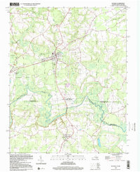
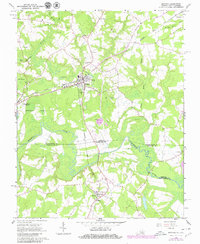
Loading map...1997 Map of Boykins
USGS Topo · Published 2000About this map
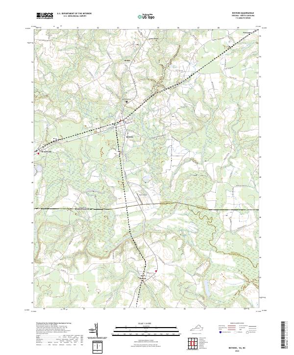
Boykins, Virginia, serves as a central hub on this landscape, positioned just north of the Virginia-North Carolina border. The area is defined by the winding course of the Meherrin River and a complex network of wetlands, including Tarrara Swamp and Buckhorn Swamp. This 1990s documentation shows the persistent agrarian and small-town character of the borderlands, where the rail lines connect settlements like Branchville and Severn.
Find a feature on this map
31 named features on this map. Tap any name to fly to it.
Don’t see what you’re looking for? This feature index may not catch every label — zoom into the map to look around manually.
Map Details
Date Portrayed1997
Date Published2000
PublisherU.S. Geological Survey
Map TypeTopographic
Scale1:24,000
Physical Dimensions22 x 26.8 inches
Editions of this 1997 Boykins Map
This is the sole edition of this map. No revisions or reprints were ever made.
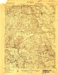
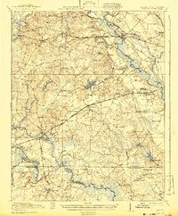
Historical Maps of Boykins Through Time
5 maps found
Featured Locations
Source Details
SourceU.S. Geological Survey
CopyrightPublic Domain