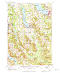
1961 Map of Boyne City
USGS Topo · Published 1971About this map
Lake Charlevoix and its long South Arm define the geography of this northern Michigan landscape, where the lake's deep waters meet the high ground of Avalanche Mountain. The era's infrastructure is visible in the Sewage Disposal plant at Boyne City and the Radio Tower overlooking the water. Moving inland, the terrain transitions into the heavily forested tracts of the Pigeon River State Forest, a region defined by complex hydrography including Intermediate Lake and the winding Jordan River.
Find a feature on this map
96 named features on this map. Tap any name to fly to it.
Don’t see what you’re looking for? This feature index may not catch every label — zoom into the map to look around manually.
Map Details
Editions of this 1961 Boyne City Map
2 editions found

Other maps of this area

1954 · Central Lake
USGS Topo · 1:62,500

1954 · Charlevoix
USGS Topo · 1:62,500

1954 · Traverse City
USGS Topo · 1:250,000

1955 · Cheboygan
USGS Topo · 1:250,000

1956 · Alba
USGS Topo · 1:62,500

1956 · Mancelona
USGS Topo · 1:62,500

1957 · Elk Rapids
USGS Topo · 1:62,500

1958 · Cheboygan
USGS Topo · 1:250,000

1958 · Traverse City
USGS Topo · 1:250,000

1958 · Bayshore
USGS Topo · 1:62,500